Planning talking points: how a city is shaped
Have you ever walked through your town or village and wondered how it came to be what it is today? Why the village hall, the church, the shops and houses are laid out in the way they are? What made one street the ‘high street’ and another a back lane?
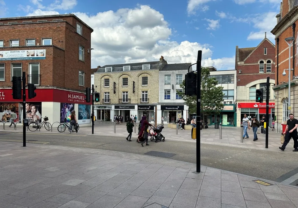
In their earliest days, many settlements were formed through a mixture of practical need and the whims of powerful landowners. In Roman times, Chelmsford was a fort on a road built between London and Colchester after Boudicca’s revolt. The layout of Chelmsford’s high street has been almost exactly the same since King John granted a market charter to the Bishop of London, who owned the land, in 1199. The row of shops in the middle of the street by Half Moon Square appeared in the 1380s when the bishop sold off pieces of his land.
Even this far back, rules were introduced to prevent irresponsible or harmful building. The first building regulation was recorded in London in 1189. Rights to construction were controlled and people were fined for building and doing things which caused nuisance and danger to others. Various attempts were made throughout history to tighten up on uncontrolled building, establish green belts and reduce the creation of slums, with varying success. So ‘town planning’ has always existed is some form, organising settlements and making sure the use of land served the people that lived there.
The planning system as we know it in England began in 1947, created to address the terrible living and working conditions caused by the rapid unplanned industrial expansion of our cities in the 18th and 19th centuries. Now, we have consistent planning regulations across the country, which aim to stop unsafe, unhealthy, or environmentally reckless development and ensure places are as beautiful, sustainable, practical, and pleasant as possible. They protect heritage, preserve rights of way, ensure infrastructure isn’t overloaded, and more. But there’s much more to planning than applying these national laws.
How planning works
Councils typically make decisions in three stages.
Firstly, they work with local residents and other agencies to decide where it’s acceptable for certain kinds of development to go. Areas of land are earmarked as suitable for housing, or business, or parks. This forms a comprehensive document called the Local Plan. This plan looks ahead into the next fifteen years and beyond, and is reviewed at least every five years.
The Local Plan provides Chelmsford with a layer of protection against unsuitable development – if a council doesn’t have one, it’s much more difficult to say no to development that isn’t right, or require developers to include facilities local people need. Some parts of Chelmsford also have Neighbourhood Plans, which are like mini-Local Plans for a village or area. Imagine a board game: these high-level plans draw up the board and decide what the basic rules are and which pieces can go in which spaces. Without rules, there’s a lot of arguing and the game won’t work very well.
Second, for larger or more complex proposals, the council consults more with local residents and others to decide on masterplans and development frameworks. These are more detailed ‘rules’, which get into the detail of what goes where on each large development site in the Local Plan.
Other public bodies get involved in these two levels of planning. For instance, Essex Highways looks after roads and transport in the city, so it is consulted about new links and routes, and public transport, as well as anything that might affect existing transport.
Lastly, when someone wants to build something, they submit a planning application to the council. In the board game analogy, this is like making a move. For a player to place a piece where they want, it has to be within the rules.
An application can be for anything from a home extension to a new shopping centre. Planners check that it’s in line with national planning policy and law, but they also look at whether the planning application fits with local planning policy and guidance including the Local Plan and any Neighbourhood Plans or masterplans affecting the area. Some simpler planning applications are dealt with by planning officers, but more complex decisions can go to the planning committee to be considered by the councillors you’ve elected to represent you.
Although a board game is a useful analogy, this process is taken very seriously. Everything that is built is influenced by the Local Plan, so these ‘rules’ affect the health, safety and happiness of all the people, plants and creatures that live in Chelmsford. It’s important to get them right.
So, the council decides exactly what goes where?
Not quite. The council oversees the Local Plan and makes decisions, but in most cases it doesn’t directly turn potential sites into homes or businesses. Certain sites and buildings in Chelmsford are marked as suitable for shops, homes or restaurants, but the council doesn’t always get involved in exactly what opens where.
If a new owner takes over premises, they don’t need to apply to the local council unless they want to change the use of those premises. For example, if a shoe shop chain takes over another shoe shop, that’s a business decision that doesn’t involve planning. But if a public house takes it over, they would need to go through a planning application process to change the use of those premises.
Equally, the council can’t choose which retailers want to come to the high street, or whether developers are interested in a site. It can only work to make the local area as attractive and good to live in as possible so that people and businesses want to be there.


So, it’s in the hands of developers and businesses?
No. Anyone can submit a planning application, but that doesn’t mean the council will say yes.
Local media often report that something ‘could’ be built in Chelmsford when a proposal is submitted. It could – or it could be found to be unsuitable and declined, or it could get permission but substantially changed so that it’s more in line with the Local Plan.
Making decisions on planning applications is a careful process. Planners need a lot of information, so proposals often include extensive detail with maps and site plans. Developers sometimes even make websites that set out their plans clearly as part of their consultation process. Again, this doesn’t mean the application will be approved – just that information has been given to the council.
So, who shapes the city? It takes a village
The truth is that how an area changes through the years is influenced by many people including: the government that makes national planning policies and laws, the local residents who input into Local and Neighbourhood Plans, the businesses and developers that decide Chelmsford is the place to be, and consultees like the Environment Agency, Essex Highways and health services.
Planning law and Local and Neighbourhood Plans have an important role in guiding decisions about all development so that it suits local needs for the future, has the right infrastructure to support it like roads and schools, and meets requirements that have been agreed democratically.
You’re part of this too and can influence Chelmsford’s future right now by having your say on the next Local Plan. We also want to hear from people that do not currently have a house or would like to see development meeting new emerging needs such as addressing new job trends or tackling climate change.
The council is currently reviewing its adopted Local Plan and consulting on a draft version called the Preferred Options, which sets out a guide for Chelmsford’s future up to 2041 and beyond. The consultation runs until 19 June 2024. Get involved at www.chelmsford.gov.uk/lp-review.