Outline of new Chelmsford riverside community agreed by Council
Guidance that will shape the development of a new neighbourhood at Chelmer Waterside has just been approved by Chelmsford City Council’s Cabinet.
A document called the Chelmer Waterside Development Framework was discussed and approved at the Council’s Cabinet meeting on 12 October, where key Councillors make important decisions on behalf of the city.
The framework sets out the key things necessary to deliver a sustainable, connected community, which include:
- over 1,000 new homes, of which 35% are genuinely-affordable
- making the most of the rivers and canals, including a potential new lock by the Essex Record Office
- a new access road and bridge
- routes to get to and from the houses by bike and foot
- good design to make sure Chelmer Waterside is sustainable and attractive
““Chelmsford is a beautiful place, surrounded by green countryside and with a lovely community. We also know that house prices are rising rapidly, homelessness is a major issue and we are facing a housing crisis. Careful planning is the way to balance providing real, affordable, high-quality homes with protecting and making the most of everything that is already here.”
Cllr Mike Mackrory, Cabinet Member for Sustainable Development at City Council
The sustainable design is expected to contribute towards Chelmsford’s objective of achieving net-zero carbon emissions in new buildings by 2030. It will also echo the historic canalside character of the area, which includes the listed Moulsham Mill and the turn-of-the-century Waterfront Place warehouse building.

Where is Chelmer Waterside?
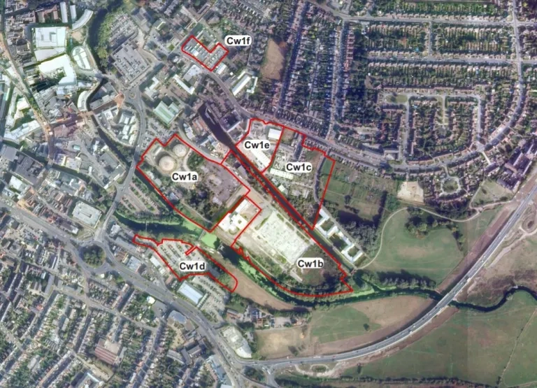
You may know the site to the east of Chelmsford city centre as the “Old Gasworks”.
Two gas holders dominated the site for decades. After they ceased to be used, they made the site very difficult to use or develop for a long time, so although it faces onto three waterways and is only a five-minute walk from the city centre, it became a wasteland that couldn’t be accessed by the public.
After 13 years of negotiations, the site was bought by the city council in 2018 and the gas holders were removed.
Now, the city council is working with gas company Cadent to design and relocate the gas pressure reduction system, which will allow housing to be safely built on the site. A planning application for this is expected later in 2021.
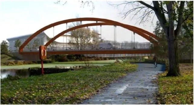
Part of the building work will involve replacing the old ‘Bailey’ bridge across the River Chelmer to the Record Office with a new one that links to Baddow Road and Parkway. The bridge design will allow boats to pass underneath for the first time in many years. Funding has been contributed for the road and bridge by Homes England and planning permission has been granted,
Other infrastructure at the site will involve reusing the gasholder frame within the development, and providing a new early years and childcare facility.

How does the council decide what goes into a Framework?
The document is based on research into what the area and its residents need to make the development work and be a pleasant place to live.
A consultation last spring was a major part of this research. 97 people took part and their views were considered and included in the report that the city cabinet discussed tonight.
What happens next?
The next stage will be the submission of the planning application for relocating the gas pressure reduction system. At the same time the Council will begin the process of selecting its development partner for Waterside.
You can keep up-to-date with the development on the City Council’s website or by signing up to the City Life mailing list for a weekly news story digest.
Council meetings are all open to the public and streamed online. Anyone can ask a question – you just have to submit it in advance so it can be included on the agenda. To find out which meetings are coming up and ask a question, check the council’s Meetings Calendar.
